
Clovis Neighbors by Parcel
Public sources about Clovis neighbors have distinct functions. The parcel map can locate a focal property and the adjoining geometry. The Assessor is the correction point for County ownership fields. The Clerk can connect a selected parcel to a recorded-party trail. NMVote can help a person verify their own registration or find a polling place, but it is not a nearby-voter search. City permit or code files need a defined request because no public address-results portal was confirmed.
| Source | What it shows about a Clovis block | Access and limitation |
|---|---|---|
| Curry Parcel Layer | Parcel geometry, situs address, assessed owner, mailing address, legal description, Book/Page | Official GIS; owners are not necessarily occupants. |
| Curry County Assessor | Ownership-data correction, parcel maps, and assessment context | County office; City GIS cannot correct County ownership. |
| Curry County Clerk | Recorded-party and title trail for a selected parcel | Online index begins in 1986; older work uses public terminals. |
| NMVote | Voting location near a street number and ZIP, plus individual verification | Not a public block-voter browser. |
| Building Safety or City IPRA | Defined permit, code, or abatement records for one address | No public address-results portal was confirmed. |
| Neighborhood Watch | Civic-program contact and safety information | No public member or street directory. |
An owner mailing address can be outside Clovis. It shows where the Assessor sends correspondence, not who occupies the parcel. A permit or abatement notice may name an owner, agent, or occupant for a particular action, but it is not a neighborhood profile.
Map Clovis Neighbors With Touches
The Curry County Map Viewer and its Parcel Layer support a bounded adjacent-parcel method. First locate the focal parcel by Property Address and note the legal description or property code. Use that parcel polygon as the query geometry. The spatial relationship called Touches finds parcels sharing a boundary. A small envelope or buffer can be used for a nearby radius, but it may include parcels that do not touch the focal lot.
The Parcel Layer query page is the source for the Clovis neighbors method.
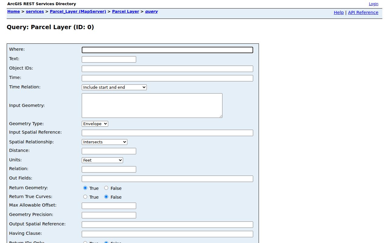
The query controls make the geography explicit, which helps distinguish shared-boundary parcels from a broad nearby search.
- Locate the address and preserve its property address, legal description, and property code.
- Use the parcel polygon as Geometry and choose Touches for shared-boundary parcels.
- Return only property address, legal description, Book/Page, owner or co-owner, mailing address, acreage, and property codes.
- Check each resulting parcel individually through the Assessor or Clerk rather than downloading a countywide list.
A touching parcel establishes map adjacency only. It does not show a social relationship, a family connection, or actual occupancy among Clovis neighbors.
Clovis Neighbors Need Parcel Context
The County layer distinguishes Property Address, Owner Name, Owner Mailing Address, Legal Description, Book, Page, Neighborhood, property codes, acreage, and geometry. These labels matter. The property or situs address identifies the land record. The mailing address is a tax-correspondence destination. The legal description connects a parcel to recorded instruments. A field named Neighborhood is assessment or location detail, not proof of a neighborhood association or a list of residents.
| Parcel detail | Proper use for a Clovis neighbors question |
|---|---|
| Property Address | Find the focal parcel in the map service. |
| Legal Description and Book/Page | Carry the land description into a Clerk record search. |
| Owner and Co-Owner | Identify the assessed names on that parcel, not a household roster. |
| Owner Mailing Address | Label as correspondence information, never as residence. |
| Geometry | Define the focal parcel, shared boundary, or small selected area. |
If an ownership field seems stale, contact the Curry County Assessor at 575-763-5731. The City GIS FAQ says City maps display County parcel information as a convenience and cannot update ownership; changes follow an updated County shapefile. That is why a City map label should not replace the Assessor’s correction process.
Clovis Neighbors and County Layers
The County GIS directory is more than a parcel display. It lists Parcel Layer, municipal limits, major roads, precincts, school districts, commission districts, Clovis municipal board districts, township and range, and reference-grid layers. Use those layers to understand the geography of a record. A parcel close to a city boundary, for example, may have a Clovis mailing label while falling outside a municipal-limit layer.
Curry County’s ArcGIS service directory shows the official layer families used to orient a Clovis block.
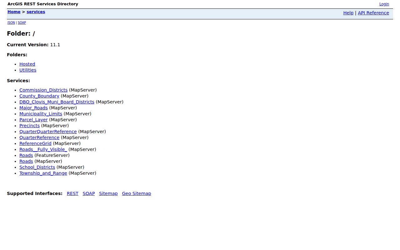
Parcel, road, precinct, and reference layers answer different location questions and should not be treated as one boundary system.
Clovis City GIS uses New Mexico State Plane East feet, NAD83. City and County Clerks maintain annexation information after Commission approval. Check the municipal-limit layer before assuming that a parcel with a Clovis address belongs to the City’s records jurisdiction.
Clovis Neighbors in Recorded Trails
For each selected parcel, carry its legal description, Book/Page, and recorded party names to the Curry County Clerk. County Records Lookup has a recorded-document index from 1986 to the present. The known index output includes grantor, grantee, recording date, and legal description. A transferor can be a prior-owner lead, but a deed party is not automatically a current occupant and New Mexico does not disclose deed sale prices.
When a selected instrument is older than the online boundary, use the public search terminals at the Clerk’s office, 417 Gidding Street, Suite 130, with an owner name or legal description. Staff do not conduct an in-depth title search or give legal advice. For a formal ownership or lien conclusion, the Clerk directs readers to a title company. Keep each parcel separate so a Clovis neighbors search does not combine unrelated land records.
City Building Safety is another limited address channel. Its online service is for applications; a public search results interface for permits or code cases was not verified. For a defined City file, use the City Clerk’s IPRA route with the address, permit type, approximate date range, and specific requested item. A request for a compiled list of people at an address is not the documented fallback.
For an entire named-street chain rather than immediate Clovis neighbors, the Clovis street directory uses the broader by-address workflow.
NMVote Is Not a Clovis Neighbors List
NMVote can find a voting location using a street number and ZIP code, but that tool answers a precinct and polling-place question. It does not return voters at an address or on a block. The individual registration interface requires first name, last name, date of birth, county, and CAPTCHA. Its identity-gated design is a clear limit on using voter records to identify Clovis neighbors.
Authorized SERVIS requests have their own form, fees, permitted fields, and use restrictions. The data may include specified registration details and voter history, but never ballot choices. Protected voters and privacy restrictions still apply. Curry County Clerk can help with the right correction or request channel, not browse an entire street for a requester.
Note: A precinct layer can explain voting geography, while NMVote cannot supply a public block-by-block resident roster.
Clovis Neighbors and Neighborhood Watch
Clovis Police confirms Neighborhood Watch groups and National Night Out programming. The public material uses the terms Close Watch, House Watch, Vacation Watch, Block Watch, and Business Watch. These are civic-participation programs, not directories of households. The source reviewed does not name individual groups, publish their boundaries, provide a member roster, or list private contacts.
Clovis Police Community Programs
For Neighborhood Watch program information, contact Community Relations Coordinator Jenny Stacey at 575-769-9413. Ask about the program and public participation options, not for membership lists.
The City’s Community Programs page is the source for this Clovis neighbors contact channel.
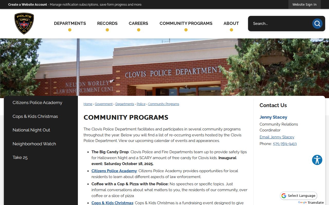
The official page supports a civic connection without converting voluntary participation into a public resident directory.
Clovis Neighbor Geography by Area
Clovis has six planning character areas: Northwest, Northeast, Southwest, Southeast, South, and Downtown. Prince Street and 21st Street mark the four quadrant areas, South Clovis lies south of the railroad tracks, and Downtown follows MainStreet Clovis boundaries. These terms can make a map conversation clearer, especially when a block crosses familiar local landmarks.
They are not postal boundaries, parcel subdivisions, voting districts, or association memberships. The City Comprehensive Plan is the source for the planning labels. Use the parcel and municipal-limit layers for a land-record question, and use the actual organization only when it provides its own public contact.
Clovis Neighbor Tools Compared
Official rolls and commercial neighbor tools serve different purposes. A County map identifies a parcel and selected assessment attributes. A Clerk index identifies recorded parties and document dates. Commercial products may combine older sources of varying quality, but they do not replace the office that maintains a record or its correction process. An opt-out from a commercial display also does not alter the underlying official record.
| Source type | Useful evidence | Limit for Clovis neighbors |
|---|---|---|
| County parcel and Clerk records | Parcel geometry, assessed owner, legal description, recorded party, date | Does not prove who occupies a home or social connections. |
| City permit or code file | Defined action at a selected property and date | Requires a bounded request when no public results portal exists. |
| Commercial people-search category | A changing compilation of sources | May be incomplete or stale; not a substitute for a custodian record. |
Follow the County or City correction route if an official parcel or City record seems wrong. Keep the request to the actual record that needs review.
Clovis Neighbors Privacy Limits
Public land records do not list all renters, household members, utility customers, driver-license addresses, or protected voters. New Mexico Case Lookup excludes address information and documents from its general public display. Voter law protects listed personal fields, and City IPRA may redact personal identifiers. Those limits remain in place even when a map shows adjoining parcels.
New Mexico Safe at Home uses a substitute address for qualifying participants. A participant’s voter record uses confidential addressing and is excluded from public voter lists. Government-held residence, delivery address, telephone number, and email are not public during participation absent a court order. The program’s dedicated application and assistant process should be used instead of an ordinary records request.
Lawful use. Use Clovis neighbor information for a personal, lawful purpose and respect every privacy boundary. Never use maps, records, or contacts to stalk, harass, intimidate, or harm anyone.