
Clovis Street Directory: Start With the Parcel
A street-by-street search begins with the Curry County Map Viewer, not with a list of households. Locate one property, then record its property address, legal description, Book/Page reference, and property code. The parcel layer can also carry an assessed owner, co-owner, owner mailing address, acreage, neighborhood, and map geometry. Those fields connect a mapped lot to county records. They do not establish who is currently staying at the address.
- Enter or locate the full Clovis address in the County map and identify the correct parcel instead of assuming every matching street label is the same place.
- Copy the property address, legal description, Book/Page, and property code. Keep the property address and any owner mailing address in separate notes.
- Use the owner name and legal description in the Curry County Clerk record process to find recorded parties connected to the parcel.
- For an older document or an uncertain result, use the Clerk public room with an owner name or legal description rather than treating the online index as complete.
- Use NMVote only to check voting-location geography from a street number and ZIP, not as a by-street list of voters.
The order matters. A parcel is a land record, a deed indexes a recorded transaction, and a voting-location result identifies a precinct context. Each can narrow a question, but none turns into a full resident roll. Note: a legal description and Book/Page are more stable research links than a loose street-name search.
Clovis Parcel Fields by Street
The County’s Parcel Layer is the strongest local address bridge. Its confirmed schema includes Property Address, Owner Name, Owner Mailing Address, Legal Description, Book, Page, 13-digit and 15-digit property codes, neighborhood, folder, card, approximate acreage, and geometry. It also exposes query controls for text, geometry, spatial relationship, distance, units, output fields, and returned geometry. Use a precise query only when its field and value are understood.
| Parcel field or control | Local use | Important limit |
|---|---|---|
| Property Address | Matches the mapped situs address | It is not an occupancy list. |
| Owner Name | Provides an assessed-owner lead | An owner need not live at the parcel. |
| Owner Mailing Address | Shows where assessment mail is sent | Mailing address is not residence evidence. |
| Legal Description and Book/Page | Connects parcel work to Clerk research | Confirm the underlying instrument. |
| Geometry and Spatial Relationship | Supports a narrow map selection | The service reports a 2,000-result maximum. |
The County map service distinguishes records geography from a familiar street name. Its layers include parcels, municipal limits, roads, precincts, school districts, commission districts, Clovis municipal board districts, county boundary, reference grids, and township/range references. A layer answers the question it was made to answer. It should not be used to infer a household from a map label.
The official Curry County parcel-layer field inventory shows the address, ownership, legal-description, and Book/Page framework used for a Clovis street directory search.
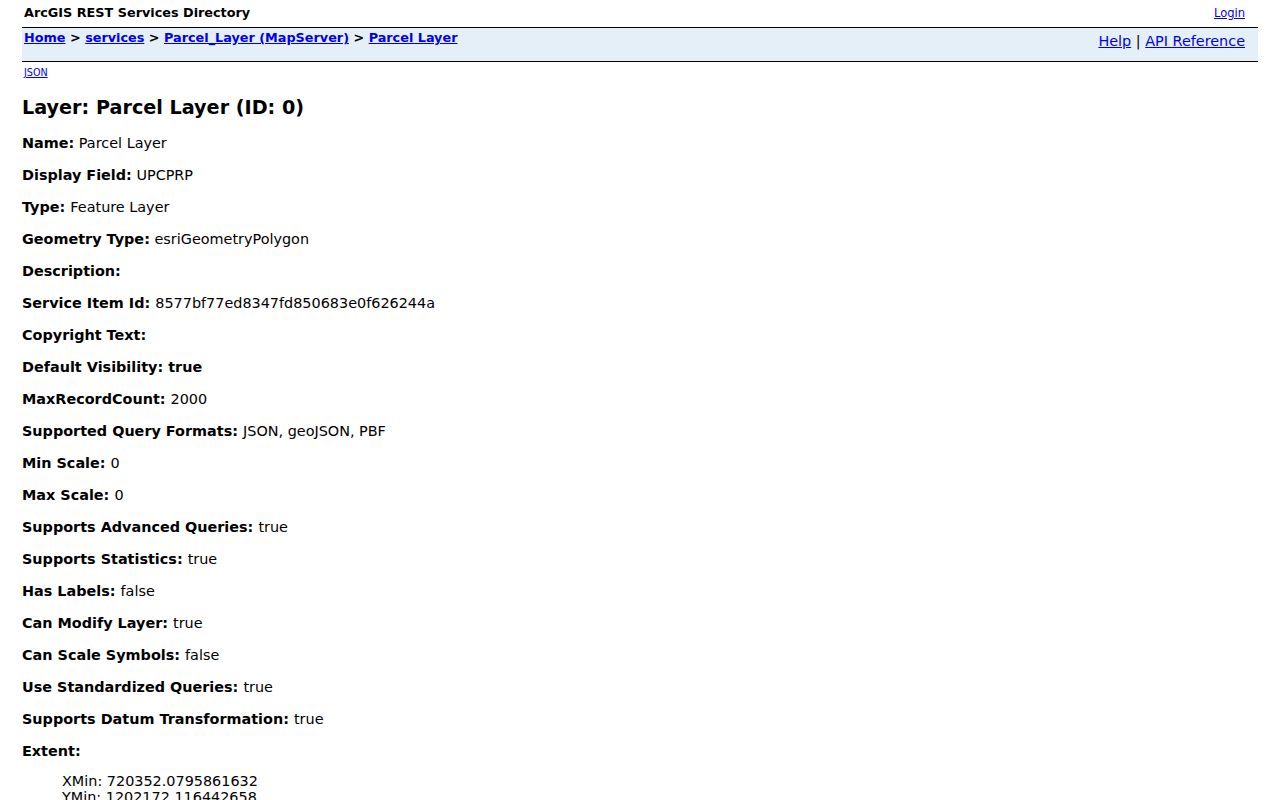
These fields support a careful parcel-to-record workflow while preserving the difference between a mapped property and the people who may be connected to it.
Clovis Address Terms for Street Records
Four terms keep a Clovis address search from drifting. A parcel is the mapped unit of land. The situs address is the property’s physical address. A plat is a recorded map that can describe lots, blocks, streets, or subdivisions. A criss-cross directory is an address-arranged directory, but one has not been verified for Clovis. Library or museum staff should confirm whether a requested historical volume has an address section before it is treated as one.
- Parcel
- A defined piece of land carried in the County assessment and mapping system.
- Situs address
- The physical property address, kept separate from an owner’s mailing address.
- Plat
- A recorded map that can supply lot, block, subdivision, or boundary detail.
- Criss-cross directory
- An address-arranged directory; its Clovis availability must be checked item by item.
The historic City Hall offers a useful local example. The National Park Service identifies the public building as both 308 Pile Street and Original Townsite Block 50, Lot 22. Retaining both forms prevents a legal-description lead from being lost when one source uses a street address and another uses lot-and-block language.
Note: the same Clovis property can require both a street address and a legal description to connect map and document records.
Clovis Street Directory Deed Trail
The Curry County Clerk maintains the County Records Lookup, whose online index begins in 1986. The County identifies grantor, grantee, recording date, and legal description as the online index information. Use a parcel’s legal description and Book/Page with the current assessed-owner name to look for a likely recorded transfer. A grantor is the recorded transferor, and a grantee is the recorded transferee. Neither label proves a present address or complete title.
When the trail reaches a pre-1986 record, move to the Clerk’s public search terminals at 417 Gidding Street, Suite 130. The County directs public-room users to search with an owner name and/or legal description. Staff do not conduct an in-depth real-estate search or give legal advice. Mail copy requests require the recording date or year, parties’ names, document type, payment, and a check or money order payable to the Curry County Clerk. Ordinary copies are listed at $1 per page; certification adds $1.50 per page.
New Mexico does not disclose deed sale prices, and the Clerk does not provide a formal title conclusion. The useful street-directory result is a documented path from a parcel to recorded parties and instrument details. For a formal ownership or lien conclusion, the County directs users to a title company. Note: the 1986 date is an online-index boundary, not the date Curry County began keeping recorded instruments.
Clovis Map Layers for a Street Search
A street can cross more than one record geography. The County viewer provides separate parcel, road, municipality-limit, precinct, school-district, and board-district layers. The City GIS is maintained in New Mexico State Plane East feet, NAD83, and the City says its parcel display is a County convenience layer. Ownership corrections belong with the Curry County Assessor, whose office is at 417 Gidding Street, Suite 160, not with City GIS.
That distinction matters when a Clovis mailing label sits outside a municipal-limit layer or when a parcel transfer has not yet appeared in a convenience display. The Assessor tracks current ownership, transfers, splits, and subdivisions through digital maps. If the map field appears stale, contact the Assessor at 575-763-5731 and keep the legal description in the request. City GIS can provide mapping and information contacts, but it cannot change County ownership data.
A careful map view may also reveal a precinct or a school district, but those boundaries should remain separate from parcel ownership and City jurisdiction. This local map geography is more useful than treating a street name as one uniform records area.
Clovis Address File Requests
City Building Safety supplies an additional address-linked channel. Its jurisdiction includes City limits and a five-mile ETJ, and its online application service handles permit applications. Research did not confirm a public address-results portal for permits or code cases. When a defined City file is needed, use the City Clerk’s records process under the New Mexico Inspection of Public Records Act, NMSA 1978 §§ 14-2-1 through 14-2-12.
A bounded request is more workable than a request for everyone connected to a street. Identify the address, permit type or code matter, approximate date range, and specific item sought, such as an application, permit, inspection, complaint closure, plan, or abatement resolution. Building material can connect an address to a dated municipal action. It is not a complete account of all people who lived there.
Permits can involve construction, alteration, repair, demolition, occupancy changes, signs, pools, curb cuts, and related work. The City application materials show why an address and legal description are worth preserving, but each current form and requested record needs confirmation from the custodian.
Note: an IPRA request works best when it identifies one Clovis address, a record category, and a reasonable date range.
Clovis Street Names That Need Two Forms
There is no source here for a citywide Clovis renumbering. There is, however, a documented local name-change lesson. In 2023 Planning and Zoning minutes, Sunshine Circle was recommended to become David Petty Circle in Morning Star Subdivision. The City’s formal street-name-change process asks for the existing and proposed segment names, contiguous-lot addresses, legal description, subdivision or block-and-lot detail, floodplain and zoning information, and a survey where applicable.
Keep both an earlier and current street form in a street-directory search when a record may span the change. The City Commission must find that a change’s benefit outweighs confusion and cost. That narrow Clovis example is a reminder to save old and current names rather than dismissing a failed address match.
Clovis Street Directory Historic Leads
The Clovis-Carver catalog identifies leads titled “Clovis City Directory” and “Clovis-Portales, New Mexico : Polk city directory.” National Park Service material cites Clovis directory years 1932, 1936, 1938, and 1941. Those citations support a request for a specific volume, not a promise that every address can be reverse-searched. For earlier street and building context, six documented Sanborn editions run from 1909 through 1962, and the 1912 volume is available from the Library of Congress.
Historical maps establish structure, block, and use context rather than a resident roster. Match a verified directory entry to the address, legal description, or block information, then compare it with a record from the appropriate custodian. For collection details and entry-reading instructions, consult the Clovis city directory.
Clovis Voting Geography by Street
NMVote has a street-number-and-ZIP tool for locating the voting location nearest an address. That is a useful geography check after a ZIP has been confirmed. It does not display a street roster or identify people at neighboring properties. The individual registration interface asks for first name, last name, date of birth, county, and a CAPTCHA, which reflects its identity-gated purpose.
Curry County’s election counter is part of the Clerk’s office at 417 Gidding Street, Suite 130. Contact the office to correct a registration record or confirm the correct request route, not to ask it to browse a street. Authorized SERVIS voter-data requests use a separate form, fees, and statutory restrictions. No public anonymous by-street voter browser was confirmed for Clovis.
Clovis Address Record Coverage
Address-keyed sources serve different purposes. The parcel record gives a current assessment view. The Clerk index links recorded parties and land descriptions. City files can document a defined municipal action. Historic materials supply dated context. Combine only the parts that answer the same question, and preserve their limits.
| Address record | Clovis or Curry keeper | What it can show | Access and limit |
|---|---|---|---|
| Parcel or property card | Curry Assessor and GIS | Situs address, assessed owner, mailing address, legal description, codes, Book/Page | Map service or Assessor; owner is not necessarily an occupant. |
| Recorded deeds, liens, and plats | Curry County Clerk | Recorded parties, date, legal description, document trail | Online index from 1986; public terminals for earlier work; no sale price. |
| Tax channel | Curry County Treasurer | Known tax-bill or owner-number search availability and tax status | Search type and four characters are required; public options were not confirmed. |
| Permits and code files | City Building Safety and City Clerk | Defined application, property, notice, or hearing material | Online application; use IPRA for records where no results portal is confirmed. |
| Historic maps and directories | Library, museum, and archival sources | Building context and dated household leads after entry inspection | Only discrete verified years; not a present-day household list. |
The Treasurer’s online tax interface requires a search type and at least four characters, but the source reviewed did not reveal its available search choices. Treat it as a verification channel for a known bill or number, not as a broad Clovis street directory search.
Note: use each Curry source for its stated record type instead of combining parcel, tax, permit, and recorded-document fields into one claim.
Limits of a Clovis Street Search
Public parcel and recorded-document fields cannot show every household member, person who receives mail elsewhere, protected voter, driver-license address, utility customer, or a complete list of who lives on a block. A recorded party is evidence of a recorded relationship. An assessed owner and mailing address are similarly limited. Court search screens exclude address and other personal-identifying information, and voter services are not a street-browsing tool.
Lawful use. Use Clovis address records for personal, lawful research and respect the access limits each custodian applies. Never use record details to stalk, harass, intimidate, or harm another person.
For corrections, ask the office that owns the record. The Assessor handles County ownership data, the Clerk handles recorded instruments and election administration, and City staff handle City-held files. This division keeps a Clovis street directory search accurate without overstating what any one source can prove.